Sustainable Rivers of North Carolina
The Nature Conservancy is managing flows on the Cape Fear and Roanoke Rivers for the benefits they provide to nature and people.

Rivers were meant to ebb and flow. Nature depends on that rhythm. Bald cypress trees need a wet-dry cycle to germinate. Fish need pulses of water to cue them to swim upstream and spawn. Mess with the rhythm of nature and the cascade of negative consequences are myriad.
Just 2% of the nation’s three million miles of waterways are undeveloped and free flowing. Rivers were dammed for water supplies, flood control, navigation and hydropower—altering the course of nature. That’s why The Nature Conservancy has partnered with the U.S. Army Corps of Engineers, the country’s largest water manager, to create the Sustainable Rivers Program (SRP). In North Carolina, that work is taking place on the Cape Fear and Roanoke rivers, both are home to large dams owned and operated by the Army Corps of Engineers. Those dams aren’t going away, but they can be managed in a way that benefits nature and people.

Ashley Hatchell, who works in water management out of the Corps' Wilmington office, says SRP fits perfectly into the Corps’ mission. “The Corps has the responsibility of helping care for our nation’s rivers, lakes, and wetlands. This responsibility goes beyond the narrow focus of flood control and hydropower that many people perceive as our primary mission,” she says. “What most do not realize is that the Corps has a strong ecosystem restoration and environmental stewardship mission also.”
How Dam Releases Can Mimic Natural Flows to Reduce Flooding
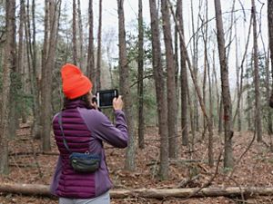
For some TNC staff, that work is born out of a deep personal connection. Merrill Lynch grew up on the North Carolina portion of the Roanoke, which spans 410 miles from its beginning in Virginia’s Appalachian mountains to its mouth in North Carolina’s Albemarle Sound. In his 27 years with TNC, he led the effort to protect land in the Roanoke basin. Today, TNC has protected 95,000 acres in the region. For Lynch it was a labor of love. “One of my feet is always firmly planted in the Roanoke River Swamp,” he explains.

North Carolina Director of Conservation Chuck Peoples is also a child of the Roanoke. He remembers playing in the tail race of the river, where the Corps had dynamited a channel through the bedrock below the massive John H. Kerr dam. “I spent many a day hiking along and swimming in the tailrace; we didn’t know fast water meant power production, just more fun. After floods, fish would get stranded in the potholes, so it was really good fishing. In reality, those fish were trapped and would eventually die. That’s a small part of the larger problem we’ve helped fix through our work.”

TNC worked with the Corps as well as Dominion Energy, which owns two smaller dams on the river, to change releases from the dam so that they more closely mimic natural flows. This reduces the amount of time that downstream areas are flooded. Those prolonged floods had eroded the forest and hurt hardwood trees and the wildlife that rely on them. The prolonged floods were also harmful to aquatic life. Flooding created stagnant backwater swamps with low oxygen stressing and killing fish.


Creating Co-Benefits Along the Cape Fear
Water Program Director Julie DeMeester joined TNC in North Carolina in 2016 as the Corps and TNC were implementing the new water management protocol. “Right as I started all that momentum was falling into place,” she says. “The Cape Fear basin has a lot of people—two million and growing—and you have rare fish and tree species, all of which are influenced by the amount of water that is in the river. All of those were selling points.”

Anadromous fish
Fish such as sturgeon, striped bass, herring, and shad spend most of their lives in the ocean but go into freshwater to spawn. Their path on the Cape Fear is impeded by a series of locks and dams near Fayetteville. Originally, locks and dams were designed so commercial traffic could move up the Cape Fear from Wilmington to Fayetteville. The commercial traffic is long gone, but they remain.
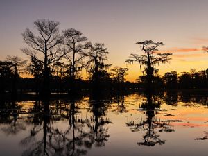
The Cape Fear River, which is North Carolina’s largest river basin, begins in the Piedmont and empties into the Atlantic south of Wilmington. It gets its name from the dangerous Cape Fear shoals that sit at the river mouth. B. Everett Jordan Dam sits in the middle of the basin, 200 miles from the Atlantic. It was completed in the early 1980s and was originally proposed for flood control. 46,768-acre Jordan Lake is a state recreational area. It also provides drinking water for fast-growing Triangle communities including Cary, Apex, Morrisville and Durham. Downstream communities including Fayetteville, Wilmington and fast-growing Brunswick County rely on the Cape Fear for drinking water.
Jordan Lake and locations in the Lower Cape Fear experience blue green algae blooms that can kill fish and harm people, cause sickness and in rare cases death. Blue green algae thrive in stagnant water that occurs in the summertime when flows are low.
Anadromous Fishes
Anadromous Fish are hatched in freshwater. The juvenile fish head out to sea, where they spend much of their adult lives, but return to freshwater to spawn. Removing manmade barriers, so that they can move upstream to spawn, is key to TNC’s river work. © NCFishes | The Atlantic Sturgeon image was taken under the authority of NMFS ESA Permit No. 21198
-

American Shad
American shad, also known as white shad, is the largest shad species. Females average 24.3 inches and males 19.7 inches. Their numbers declined over much of the 20th century due to overfishing and habitat degradation in their spawning areas.
-

Atlantic Sturgeon
Atlantic sturgeon are protected under the Endangered Species Act. Sturgeon mature and grow slowly. Males take a decade to reach sexual maturity—females twice as long. They are the largest fish in North Carolina freshwaters, weighing up to 800 pounds.
-

Blueback Herring
Blueback herring, also known as river herring, reach a maximum of 16 inches and live for 8 years. Because of their reduced numbers, there is a moratorium on harvesting blueback herring in North Carolina.
-

Striped Bass
Striped bass, also known as rockfish, start spawning when they are 2 to 4 years old. Although stripers are found in several North Carolina river basins, the Roanoke River is home to the state’s only wild population of stripers.
A Prescription for Cape Fear
TNC and the Corps analyzed conditions on the Cape Fear before and after Jordan Dam was built. Then, they summarized the implications of the dam on those three areas. “Prior to the dam, the river at Lillington (a town in Harnett County about 30 miles south of Raleigh) flooded over its banks at least every other year, usually more. After the dam was built, it almost never happened,” says DeMeester. “That holds true further downstream. You’ve removed big pulses from the river, disconnected the floodplain from the river, potentially reduced cues for fish to swim upstream, and likely altered water quality.”
DeMeester and the Corps brought experts from across the region who were concerned about fixing flows on the Cape Fear. Diverse interests were represented—local and state government, utilities, conservationists and scientists. They took all the available data to create the ideal flow rate for the interest they represent. Fisheries biologists were looking at what was best for the anadromous fish. Utilities were looking at what would reduce algae that harms drinking water. The flow prescriptions were combined to find common ground, differences and ultimately to create a unified flow prescription for the river.
“We negotiated a giant flow prescription,” says DeMeester. “At the end of the meeting, everyone needed a giant beer, but we walked away with a unified prescription for the river.”
Mick Noland, who is Chief Water Officer for the Fayetteville Public Works Commission was part of process. “Fayetteville has a high interest in anything being done at Jordan Lake. That’s our water conservation pool,” he explains. “Anything that can be done to manage flows that will improve water quality will make it easier and more manageable to treat water before sending it to consumers.”
Today, the Corps is putting that prescription to work. In the spring as fish try to make their way upstream to spawn, the Corps releases mini pulses from Jordan dam, which cover the locks and give the fish swimming room. In the summer heat, when stagnant conditions develop downstream, the Corps releases pulses to stir up the water and impede blue green algae blooms.
DeMeester can hardly contain her enthusiasm about the SRP work. She is taking the long view. In addition to restoring more natural flows on the Cape Fear, she wants to see floodplain along the Cape Fear reconnected helping to make communities more resilient to large rainfall events. There are more fish-friendly bridges to be built on the Roanoke. “There’s lot’s to be done, but we have made a really good start,” she says.
Hear Updates from the Field
Subscribe to receive monthly conservation news and updates from North Carolina
Sign upRelated Articles

Modeling Pollution on the Cape Fear River
Chapter Watershed Scientist Danica Schaffer-Smith is creating a model that gives TNC and other organizations a better picture of water quality across the Cape Fear River basin.
Monitoring Conservation Easements
Easements are a hallmark of TNC's work across North Carolina, and Conservation Coordinator Lauren Goodman’s job is to make sure we’re caring properly for these protected lands.
Sustainable Rivers Program
The Nature Conservancy and the U.S. Army Corps of Engineers are finding new ways to strike a sustainable balance in how people use and protect the many benefits that rivers provide.